| Butterfield
Overland Mail Route Page4 Butterfield Route Page1 2 3 4 5 6 7 8 9 10 11 12 Next |
| Butterfield
Overland Mail Route Page4 Butterfield Route Page1 2 3 4 5 6 7 8 9 10 11 12 Next |
 |
 |
||
|
(October 14, 2012) Enlarge Trace of the Butterfield Trail south of the commemorative monument, headed southwest to Boggy Depot |
||
 |
 |
||
|
(March 1, 2012) Enlarge Map Webmaster at Butterfield sign on Wesley Road, approximately 3 mi. east of Stringtown Sub-Prison
N34 32.187 W95 59.690 |
(March
1, 2012) Enlarge
Map
Map-2
Waddell's Station. Northeast of Stringtown, Atoka County. Station marker at
center of picture. View looking north from Wesley Road
1.
Geary's Station - Wikipedia |
||
 |
 |
||
|
(March
1, 2012) Enlarge
Detail Oklahoma Historical Society
marker for
Waddell's Station |
(March 1, 2012) Enlarge Map Butterfield Stage crossing of Nolitubbee Creek approximately 1/2 mi. north of Wesley corner. The deep cut is in the far left bank
N34 35.609 W95 53.162 |
||
 |
 |
||
|
(March
1, 2012) Enlarge
Map
Map-2
Detail
Oklahoma Historical Society
marker for
Blackburn's Station. The marker plaque is missing. Station site
approximately 100 yards behind marker. View looking west. 1/2 mi. south of
Pine Top school, southwest of
Hartshorne, Pittsburg County |
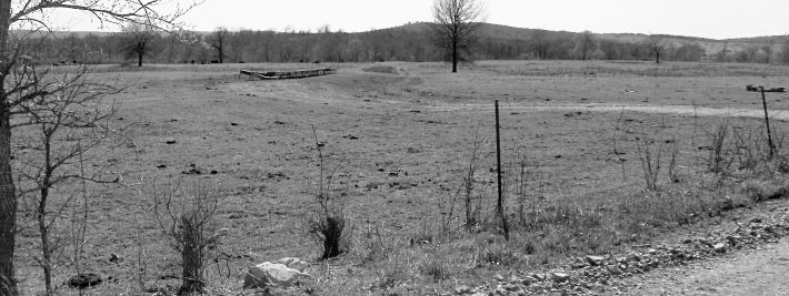
(March 1, 2012) Enlarge Map Map-2 Oklahoma Historical Society marker for Pusley's Station. Trace of stage route in background. The marker plaque is missing from the broken base. View looking southwest. Southeast of Hartshorne, Latimer County
N34 47.806 W95 27.962 |
 |
|
(March
1, 2012)
Looking southwest from Pusley's Station marker. The OHS marker was placed
in a trace of the stage route Photo by Webmaster |
Civil War in Indian Territory Home Site Index Butterfield Route Page1 2 3 4 5 6 7 8 9 10 11 12 Next
![]()