Butterfield Overland Mail Route Page11
 
www.CivilWarAlbum.com Home
Civil War in Indian Territory Home
Civil War in Indian Territory Index

Butterfield Route Page1   2   3   4   5   6   7   8   9   10   11   12   Next
 
Photos this page courtesy of Webmaster
 

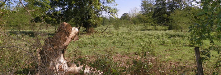
(October 7, 2012) Enlarge  Map Site of Brazil Station, shallow ridge in background.  About 5 1/2 mi. west and 1/2 mi. north of Shady Point, or 3 1/2 mi. northeast of Trahern's Station. View looking east from county road
 
Brazil Station, while not an official station on the Butterfield Trail, was important from the early beginnings and until after the Civil War. The station was established by Washington McDaniel and Charles M. James, to whom the right had been granted by the General Council of the Choctaw Nation in October, 1858 to operate and maintain a toll bridge on Brazil Creek

 
N35 08'09.32 W94 46'03.73
 
Links:
1. Oklahoma Stations: Butterfield Overland Mail Route
2. Trails Linking the West - Ceil's Corner


(October 7, 2012) Enlarge  Camera Location Brazil Creek bottom land, south of Bokoshe, Lelflore County. View looking south from Buck Creek Mountain. Cavanal Mountain is seen in background. Butterfield Trail crosses left-to-right thru center of picture


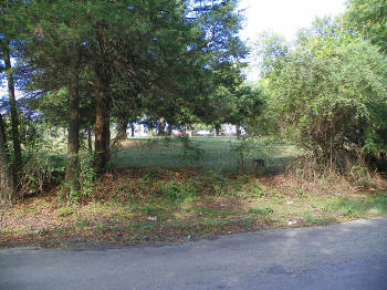
(October 7, 2012) Enlarge  Map Walker's Station. Skullyville, Leflore County. The old station (formerly the Choctaw Agency, 1832) later known as the Ainsworth place, burned on September 23, 1947. The station was operated by Tandy Walker, later a Confederate Colonel and commanding officer of the 1st Choctaw and Chickasaw Mounted Rifles
 
Walker's Station occupied the high ground in center background. The ruins of a 20th century structure (recently burned) sits on the former site of the station. View looking north
 
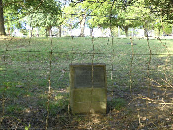
Walker's Station marker located due east of the station site, on the west side of the county road and in the center of a trace of the old Butterfield road which can be seen in the right half of the picture
 
www.CivilWarAlbum.com: Skullyville
www.CivilWarAlbum.com: Choctaw National Cemetery (Skullyville)
 
N35 15.111 W94 35.458
 
Links:
1. Walker's Station - Wikipedia
2. Exploring Oklahoma History - Walker's Station
3. Historic Oklahoma: Gold, Choctaws, and Covered Wagons; the Story of Old Skullyville

4. LeFlore County, OK History


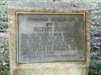
(October 7, 2012) Enlarge  Map Oklahoma Historical Society marker for Walker's Station. Marker located due east of the station site (high ground in background), on the west side of the county road and in the center of a trace of the old Butterfield road. View is looking west

(October 7, 2012) Enlarge Walker's Station marker


(October 7, 2012) Enlarge Walker's Station marker


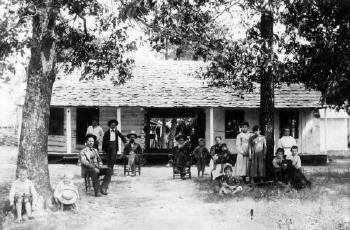
Enlarge The remodeled Choctaw Agency House (Walker Station of Butterfield days). The Ainsworth's remodeled the house in 1892 (according to Dr. Hartshorne). The original 1832 house had three large log rooms (S, M, N). The one-foot hewn logs came from Cavanal Mountain, and the red cedar shingles from local sources. The North room's roof had leaked too much, so the new Ainsworth owners decided to remodel the house. The northern log room was torn down, and a new frame wing of the house was built. New weather boards, roof, ceilings, and white painting were applied all around the house. The picture (Source: Oklahoma Historical Society) of the remodeled house was taken about 1894 (according to Dr. Messer's best guess based on KCS timetable thru Spiro). Widow Ainsworth lived in the house until it burned on 9-23-1947. CSA Brig. Gen. Frank C. Armstrong was born in this house on November 22, 1835. This was the money house to the Choctaw's of Skullyville fame

Civil War in Indian Territory Home     Site Index     Butterfield Route Page1   2   3   4   5   6   7   8   9   10   11   12   Next