| Vicksburg Campaign,
a Virtual Tour Grant Moves Inland Crossing of Big Bayou Pierre Battles of Raymond and Jackson Photos taken by Webmaster unless otherwise noted Please Contact me for any use of these images |
| Vicksburg Campaign,
a Virtual Tour Grant Moves Inland Crossing of Big Bayou Pierre Battles of Raymond and Jackson Photos taken by Webmaster unless otherwise noted Please Contact me for any use of these images |
 (wartime route between Vicksburg and Port Gibson) |
Links: |
| Photos: |
 |
 |
||
|
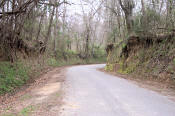
(3-01)
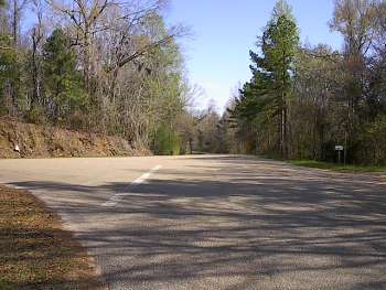
Enlarge Hardscrabble Crossroads.
View looking north up old US-61, the wartime main road between Vicksburg and Port
Gibson. Confederates
withdrawing from Grand Gulf turned north here crossing the Big Black
River at Hankinson's Ferry, 3� miles
north
|
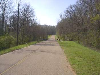
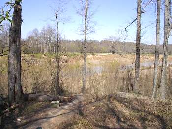
(3-01) Enlarge Kennison Creek. One mile south of Hardscrabble Crossroads. View looking south. Cockrell's Confederate Brigade was deployed nearby overlooking the creek to cover Loring's crossing of the Big Black at Hankinson's Ferry |
||
 |
 |
||
|
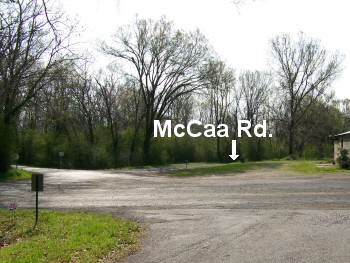
(3-01)
Enlarge Willows
(wartime Willow Springs). View
looking east up Old Port Gibson Road. Historic McCaa
Road from
Grindstone Ford at right. Historic Ingleside Road at left. McClernand's
XIII Corps camped here May 3-7 |
(3-08) Enlarge Willows (wartime Willow Springs). Junction of Old Port Gibson Road, McCaa Road and Ingleside Road. Old Port Gibson Road runs from left to right across the picture. View to the south from Ingleside Road |
||
 |
 |
||
|
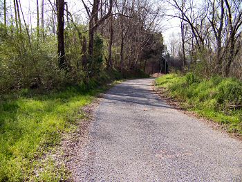
(3-08) Enlarge Willows (wartime Willow Springs). McCaa Road 0.1 mi. south of Old Port Gibson Road, view looking south. McCaa Road crossed Bayou Pierre on a suspension bridge at Grindstone Ford. The action on the road and at the bridge site is explained in the marker at right |
(3-2020)
Enlarge
Interpretive Marker at Willows (wartime
Willow Springs) |
||
 |
 |
||
|
(3-2020) Enlarge Junction of Old Port Gibson Road and old US-61 (wartime route to Vicksburg). The wartime route is on the left. Old Port Gibson Road continues approximately 5.7 mi. to the Rocky Springs town site. |
(3-2020)
Enlarge One of two
Interpretive Markers at the road junction |
||
 |
 |
||
|
(3-2020)
Enlarge Other Interpretive
Marker at
the junction of Old Port Gibson Road
and old US-61 (wartime route to Vicksburg) |
(3-01) Enlarge Grindstone Ford at Bayou Pierre. View looking north from post Civil War bridge approach. Remains of wartime bridge approach are below near the trees. Following the May 1 battle of Port Gibson, Baldwin's Confederate Brigade marching to rejoin Bowen's command near Grand Gulf, crossed the suspension bridge here at midnight firing it behind them. The next day Federal forces extinguished the flames and found the bridge only partially destroyed. After completion of repairs early morning of May 3, the Federals crossed Bayou Pierre running into a Confederate roadblock south of Willow Springs on McCaa Road |
Inland Route Page1 Page2 Page3 Page4 Page5 Page6 Next
Return to Vicksburg Campaign, a Virtual Tour
![]()