|
Photos/text courtesy of Webmaster
unless otherwise noted For any use of these photos contact Webmaster
Grant's March Page1
Page2
Page3 Page4
Page5
Page6
|
|
Grant's March in Louisiana Page9
|
Photos/text courtesy of Webmaster
unless otherwise noted For any use of these photos contact Webmaster
Grant's March Page1
Page2
Page3 Page4
Page5
Page6
|
|
 |
 |
|
|
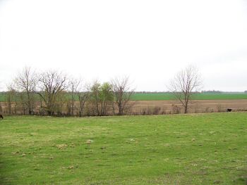
(March 2009) Enlarge Yucatan Lake, wartime channel of the Mississippi River. View looking east from about 1/4 mi. west of Hard Times Landing |
(March 2009) Enlarge Area south of Hard Times Landing |
|
|
|
||
 |
 |
|
|
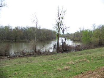
(March 2009) Enlarge Somerset (John Perkins' plantation). View from levee at Palmyra Bend, wartime channel of the Mississippi River |
(March 2009) Enlarge Wartime bed of the Mississippi near Somerset |
|
 |
 |
|
|
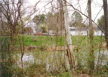
(March 1997) Choctaw Bayou, looking north. SH-605 near west shoreline of Lake Bruin, south of Newellton, LA. Site of an April 28, 1863 skirmish between a Federal combat patrol and Confederate cavalrymen positioned on the south side of the bayou |
(March 1997) Choctaw Bayou, looking east toward Lake Bruin |
|
 |
 |
|
|
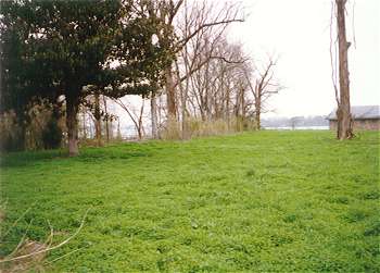
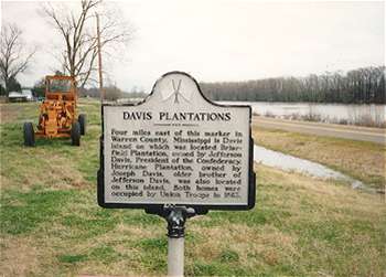
(March 1995)
LA SH-608 east of Newellton, LA. No original structures remain
today at Davis Island. Federal troops burned the Joseph Davis mansion,
Hurricane, in 1862. Brierfield burned accidentally in 1931, and the
Davis heirs sold the plantation in 1951. A map is on display at the Old
Court House Museum in Vicksburg showing changes to this area as a result
of the Mississippi River changing course |
(March 2009) Close-up of Davis Plantations marker |
Grant's March Page1 Page2 Page3 Page4 Page5 Page6 Page7 Page8 Page9 Next
Return to Yazoo Pass-Siege of Vicksburg Return to Vicksburg Campaign, a Virtual Tour
![]()