 |
|
 |
|
(2015) Enlarge
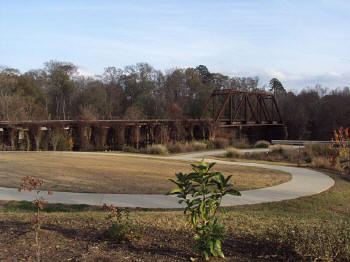
Big Cypress Bayou |
|
(2015) Enlarge
Interpretive Marker: Jefferson Turn Basin |
|
|
|
|
 |
|
 |
|
(2015) Enlarge
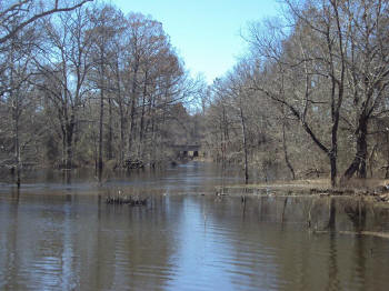
Big Cypress Bayou
Big Cypress Bayou (in modern parlance Big is usually dropped) flows
eastward - left in these photos - through Lake Cypress, Texas' only
natural lake and one which it shares with neighboring Louisiana. Then the
water level was much deeper owing to what was called the Great Raft, a
massive miles-long logjam on the Red above modern Shreveport which acted
as a natural dam, making Shreveport head of navigation on the Red and
raising the water level in all its tributaries. The area shown in the park
was then largely covered by water, allowing small shallow-draft steamboats
space to turn around for their return trip. The town began as a ferry at
this point which was also the head of navigation on Cypress Bayou. The
railroad bridge pictured crosses the stream today, but trains did not come
here until well after the Civil War and too late to save the town's
by-then slumping economy. |
|
(2015) Enlarge
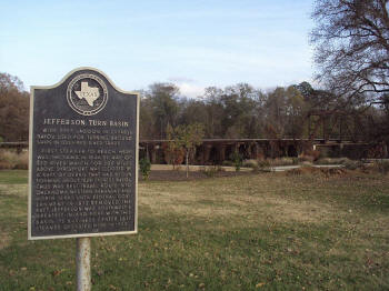
Jefferson Interpretive Marker
As the historical marker describes, Jefferson was an important shipping
and small manufacturing site for the Confederacy; goods from Texas were
shipped from here through Lake Cypress on to the headquarters of the
Trans-Mississippi Confederacy at Shreveport. This included gunpowder made
in powder mills a dozen miles south in the country nearer to Marshall,
Texas. During Reconstruction, anti-government sentiment ran so high a
Federal garrison was established here to protect Freedman and government
property and enforce Reconstruction laws. |
|
|
|
|
 |
|
 |
|
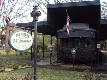
(2015) Enlarge
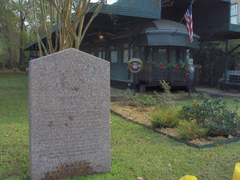
Jay Gould's Railroad Car
Many years later during the Great Depression and well after Gould's death
what was believed to be his private rail car was discovered on a siding
being lived in by otherwise homeless vagrants. It was brought here where,
though lovingly preserved and protected near Jefferson's historic
waterfront, it sits somewhat forlornly, empty of furnishings and sans its
trucks which gives it a rather odd low-slung appearance. |
|
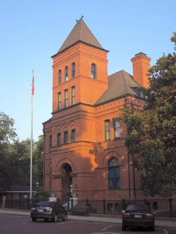
(2015) Enlarge
Jefferson Historical Society and Museum
Jefferson's economy did not die immediately, but rather began a steady
decline from which it has never recovered; today the population hovers
around 2,000. Somewhat ironically the United States government built the
magnificent structure above to serve as a combination post office and
Federal court building in 1888 on Austin Street; today it houses the
Jefferson Historical Society and Museum. Jefferson's decline proved to be
a boon for historical preservation as many buildings such as this as well
as very many Victorian homes built as far back as the 1840's were left in
neighborhoods largely untouched by "progress" and development to molder
until their rebirth following WWII as Texas' bed-and-breakfast capital. |
|
|
|
|
 |
|
 |
|
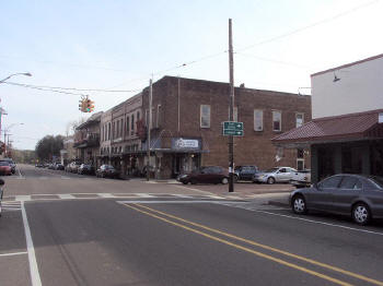
(2015) Enlarge
Polk Street
Like most American towns and cities of the era, Jefferson's streets were
named for its pioneers and statesmen of the day; above is the main NE - SW
route, Polk Street, named for James K. Polk, President during the town's
founding. The commercial buildings remaining here in the heart of historic
downtown postdate the Civil War but are very much in the style of those
present then. In the distance Polk St. crosses Cypress Bayou in the area
of the turning basin in the post at top of this page; at the far end of
the row of buildings stands the 1920's Marion County Courthouse complete
with its Confederate Monument on the corner. |
|
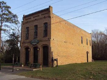
(2015) Enlarge
Early Jefferson Lodge Building, now
McGarity's Saloon
Two of what were once many similar period warehouse buildings remain on
Dallas St. which was the last before the bayou where piers extended across
marsh land to the riverboat landings. Above is the ca. 1860 building built
as a livery but which during the war held a Confederate hat factory. As
postwar McGarity's Saloon it flourished until 1868 when its proprietor was
indicted for "retail sale of vinous liquors," "permitting gaming," and
having a "disorderly house." This structure was nearing collapse around a
century later when it was rescued as a restoration project of the local
high school. |


