|
North Anna
Battlefield Park, Verdon Road (state Route 684) adjacent to the Martin
Marietta Aggregates Quarry in Doswell. A 75-acre
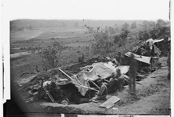
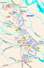 park offering trench
works with rifle pits, which are considered among most pristine Civil War
earthworks in existence. The park, which opened in 1996, has a 1- to
2-mile out-and-back walking trail with guided signs along the path with
information on the battlefield and history. Much of the park is passive
wooded area, and it overlooks the North Anna River. More than 150,000
soldiers faced one another in May 1864 and the battlefield was an
important precursor to the Cold Harbor campaign. park offering trench
works with rifle pits, which are considered among most pristine Civil War
earthworks in existence. The park, which opened in 1996, has a 1- to
2-mile out-and-back walking trail with guided signs along the path with
information on the battlefield and history. Much of the park is passive
wooded area, and it overlooks the North Anna River. More than 150,000
soldiers faced one another in May 1864 and the battlefield was an
important precursor to the Cold Harbor campaign.
Directions: Take I-95 north to Exit 98, go west on state Route 30 to U.S.
1 and turn right. After 1.5 miles, turn left onto state Route 684 and look
for the park entrance on the right after about 2.5 miles.
Info: 365-4695
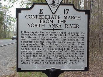
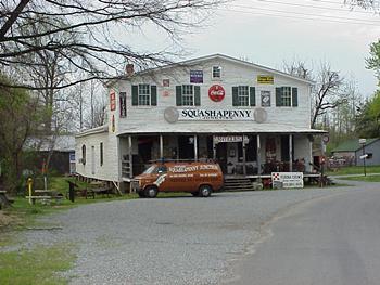
North Anna Battlefield Park
HISTORY
It was the final year of the Civil War, and the fighting was growing
increasingly desperate in the heart of Virginia.
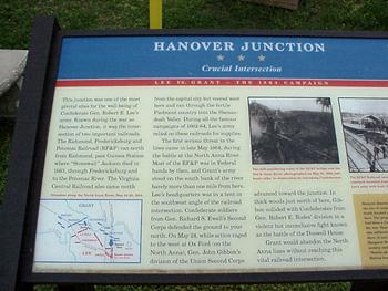
In an attempt to protect the crucial railroad junction in Hanover, Gen.
Robert E. Lee devised a brilliant strategy. His troops staked out high
ground along the North Anna River and built an impressive series of
defensive earthworks in the shape of an inverted V.
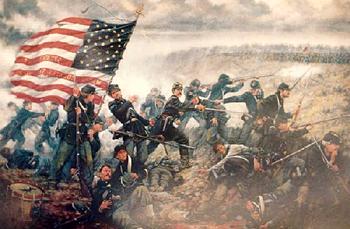 They would lure the Federal troops across the river, effectively dividing
them. Their position would force Gen. George Meade to cross the river
twice in order to reinforce his separated corps. They would lure the Federal troops across the river, effectively dividing
them. Their position would force Gen. George Meade to cross the river
twice in order to reinforce his separated corps.
It would have been a much-needed victory for the Confederates, but it was
not to be.
Lee lost this golden opportunity. He was too sick to take the field and
did not believe any of his inexperienced corps commanders could win a
major battle against the numerically superior Federal forces.
Both sides withdrew after a few minor skirmishes, and the site of Lee's
lost opportunity has been mostly overlooked in the history books
|

