| Champion Hill Home |
| Civil War Album Home |
| Return to Yazoo Pass - Siege of Vicksburg |
 |
 |
|
|
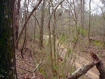
Jackson Road cut a few yards north of the Crossroads. The view is from the west edge of the wartime cornfield Locate on Map
|
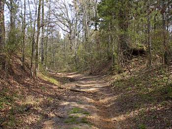
The Jackson Road trace as it curves toward the crest of Champion Hill. Bowen's attack continued unabated through this portion of the battlefield as the beaten Union troops retreated across the same ground that they had victoriously taken earlier in the day. Along the way, Bowen ordered his men to retrieve ammunition from the dead and wounded soldiers that they came across during their advance Locate on Map |
|
 |
 |
|
|
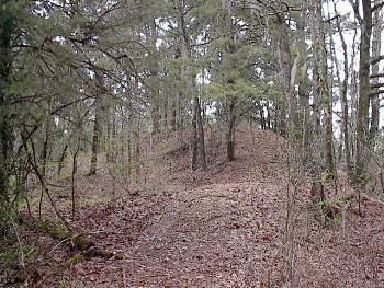
View of the
crest of Champion Hill from the south. As Bowen's
soldiers retook the crest, they were able to recover the artillery
that Cumming's men had been forced to
abandon during the initial Union assault |
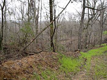
Because of
depleted ammunition and the injection of fresh Federal troops under
Brigadier General Marcellus M. Crocker, Bowen's
counterassault came to a halt around the ground pictured above, which
is approximately 350 to 400 yards north of the crest of Champion Hill.
From near this area, Bowen heard that McClernand had broken through
the Confederate roadblock on the Middle Road and was approaching the
crossroads. To prevent being cut off from his escape route and caught
between two Union forces, Bowen decided to retire. The Confederate
mass retreat began
Locate on Map
|
|
 |
 |
|
|
Click image to enlarge Cockrell's Counterattack Interpretive Marker on old Jackson Road between the Crossroads and the crest of Champion Hill |
Click image to enlarge Looking south from the counterattack marker. Old Jackson Road cut leads to the Crossroads just beyond the trees in left background |
|
 |
 |
|
|
Click image to enlarge Looking north from the counterattack marker. Crest of Champion Hill in far left background |
Click image to enlarge Champion Heritage Foundation Marker at location of Hovey's 16-Gun Battery. Marker set in 2015 |
|
 |
||
|
Click image to enlarge Hovey's Battery site and graveyard mentioned in the marker. Several unmarked graves are scattered about the mound. View is looking east |
