| Champion Hill Home |
| Civil War Album Home |
| Return to Yazoo Pass - Siege of Vicksburg |
![]() n
the first segment of the battle of Champion Hill, the Confederate division
of Carter Stevenson holding the northern end of the Southern line had been
beaten badly. On the Union left, General Hovey had dismantled the
Confederate salient on the crest of Champion Hill, taken the valuable guns,
and forced them to retreat south of the crossroads. On the right, Logan's
troops were able to turn the Confederate left flank and take possession of a
section of the Jackson Road, thereby standing in between Pemberton and his
escape route. Only in the center did the Confederate line hold. There, along
roughly a two-mile stretch just west of the crossroads, Lee's
Alabamians and parts of Barton's Georgians
prevented the Yankees from controlling the entire Jackson Road. However,
their hold was tenuous. Before Hovey's and Logan's
troops could get reformed, Pemberton and his Confederates had to try and
assault them. The Confederate commander rushed to call up reserves that
could break the Union hold on the crossroads. Because General William W.
Loring was no where to be found, Pemberton had only to rely on one division
consisting of the two Missouri brigades of Francis M. Cockrell and Green to
save his army from disaster. Commanded by Brigadier General John S. Bowen,
the division marched into battle shortly after 2 o'clock
that afternoon. They were able to catch the Federals maintaining the
crossroads unaware, and the Confederates quickly regained possession of the
vital road junction. The howling Confederates pushed the exhausted Yankee
troops back over the earlier battleground, regaining the crest of Champion
Hill and the artillery left behind. However, their advance faltered within
site of the Champion house and the Union wagon train due to depleted
ammunition and a stiffened Federal defense. While Bowen was frantically
pleading for reinforcements and ammunition, he ordered his men
to retrieve what they could from the dead and
wounded scattered along the way. Around 4 o'clock,
Bowen realized that he could not press the issue any further without
significant reinforcements. The tide of battle was about to change again,
this time not in the Confederate's favor.
n
the first segment of the battle of Champion Hill, the Confederate division
of Carter Stevenson holding the northern end of the Southern line had been
beaten badly. On the Union left, General Hovey had dismantled the
Confederate salient on the crest of Champion Hill, taken the valuable guns,
and forced them to retreat south of the crossroads. On the right, Logan's
troops were able to turn the Confederate left flank and take possession of a
section of the Jackson Road, thereby standing in between Pemberton and his
escape route. Only in the center did the Confederate line hold. There, along
roughly a two-mile stretch just west of the crossroads, Lee's
Alabamians and parts of Barton's Georgians
prevented the Yankees from controlling the entire Jackson Road. However,
their hold was tenuous. Before Hovey's and Logan's
troops could get reformed, Pemberton and his Confederates had to try and
assault them. The Confederate commander rushed to call up reserves that
could break the Union hold on the crossroads. Because General William W.
Loring was no where to be found, Pemberton had only to rely on one division
consisting of the two Missouri brigades of Francis M. Cockrell and Green to
save his army from disaster. Commanded by Brigadier General John S. Bowen,
the division marched into battle shortly after 2 o'clock
that afternoon. They were able to catch the Federals maintaining the
crossroads unaware, and the Confederates quickly regained possession of the
vital road junction. The howling Confederates pushed the exhausted Yankee
troops back over the earlier battleground, regaining the crest of Champion
Hill and the artillery left behind. However, their advance faltered within
site of the Champion house and the Union wagon train due to depleted
ammunition and a stiffened Federal defense. While Bowen was frantically
pleading for reinforcements and ammunition, he ordered his men
to retrieve what they could from the dead and
wounded scattered along the way. Around 4 o'clock,
Bowen realized that he could not press the issue any further without
significant reinforcements. The tide of battle was about to change again,
this time not in the Confederate's favor.
Counterassault, May 16
 |
 |
|
|
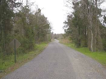
The Ratilff Road (modern D. J. Johnson Road) as it approaches the crossroads. This photograph was taken near the Isaac Roberts' house site looking to the north. The crossroads would be near the treeline in the distance. After the initial rout of Confederate forces on Champion Hill, Brigadier General John S. Bowen was called on to deliver a massive counterassault on the Union contingent holding the crossroads. He deployed the two brigades of Francis M. Cockrell and Martin E. Green to do the work. The brigades marched up this road, and hit the exhausted and depleted Union soldiers at the crossroads. Initially successful, Bowen's counterattack briefly removed any Union presence from Pemberton's escape route � the crossroads Locate on Map |
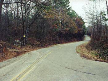
Site of the wartime Issac Roberts home which served as Pemberton's headquarters during most of the battle. As Bowen's fresh troops passed here, Southern women who had gathered in the front lawn cheered his troops on with verses from "Dixie" Locate on Map |
|
 |
 |
|
|
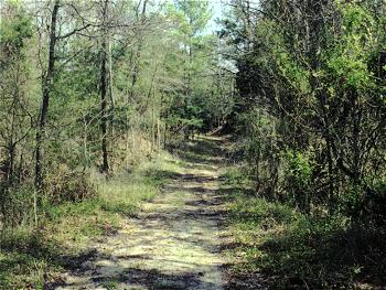
The mass of
Bowen's troops first came into contact with
the Yankees here, at the crossroads. The bewildered Federals, unable
to maintain their ground against the overwhelming Confederate forces
fell back down the Jackson Road, which is to the left of the picture.
Meanwhile, McClernand's divisions facing the
Confederate roadblock on up the Middle Road were unavailable for
assistance
Locate on Map
|
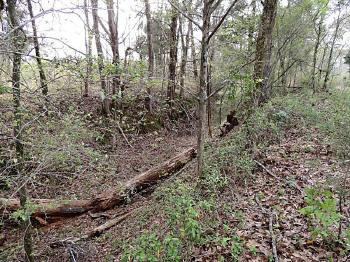
Enlarge The Jackson Road trace in between the crossroads and Champion Hill. As Bowen pressed his attack on the retreating Federals, some of the bloodiest fighting of the battle took place on this stretch of ground. Some accounts say that the dried ruts in the road ran red with the blood of both Yankees and Confederates. The view is looking north toward the crest of Champion Hill Locate on Map |


