 |
 |
|
|
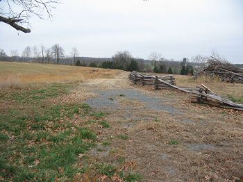
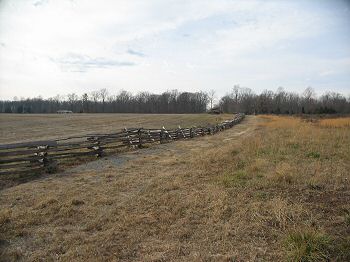
(12-2007) Enlarge Garnett's Confederate Brigade line ran along the old road bed looking to the east. At the time of the battle the area to the right of the fence line was open field, and the Orange and Culpeper Road ran along the fence. The ground to the left of the fence (including the center foreground) was wooded. About where the gravel path ends here, a farm lane intersected the road and extended to the west (to the left). The 48th Virginia Infantry defended here, at an apex, to the left of the 21st Virginia. The 42nd Virginia and the 1st Virginia Battalion extended the Confederate lines about 100 to 200 yards to the west (running out of the photo to the left) of the 48th, into the woods. But the left flank at that point was not protected. Furthermore, the 48th, 42nd, and 1st Battalion were all posted within the woods with no clear fields of fire or view of approaching enemy troops. Crawford's Federals hit at this vulnerable spot and turned the exposed flank |
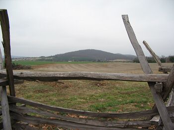
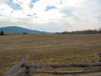
(12-2007) Enlarge The 21st Virginia's Position about halfway down the old roadbed looking at Cedar Mountain. Augur's Federal Division, with Geary's Brigade closest to the point of view, advanced across the field to the front here, beyond the fence, towards Crittenden Lane on the right side of the photo. Clearly apparent from this view is the cross fire the Federals encountered. With the artillery on the shelf of Cedar Mountain (dark green stand of trees on the mountain) firing from the east, Early and Taliaferro's men firing from the south (the present day General Winder Road, right of photo), and the 21st Virginia firing adding their fire from behind this fence, the Federals were hit on three sides |
|
|
|
||
 |
 |
|
|
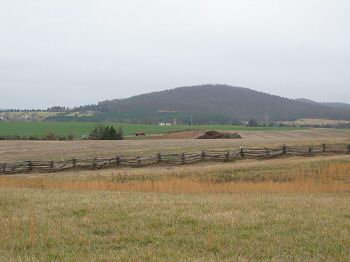
(12-2007) Enlarge Another view of Cedar Mountain, looking across the Confederate lines. Crawford's brigade advanced through the foreground here, from left to right. Then the brigade pressed into the gap presented in the Confederate line. At the time of the battle this was the edge of the wood line |
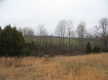
(12-2007) Enlarge Crawford's Brigade Advances. Looking northwest from the north edge of the battlefield park. Between 5:45 and 6:15 in the afternoon, Crawford's Brigade advanced from the high ground beyond Dove Hill Road against the Confederates line, mostly composed of Winder's (Stonewall) Division. Crawford's advance was on the west side of and generally parallel to the Orange and Culpeper Road. From east to west the regiments engaged were the 5th Connecticut, 28th New York, 46th Pennsylvania, and the 3rd Wisconsin. The 46th Pa Infantry entered the tree line behind the left flank of the 1st Virginia Battalion, thus turning the Confederate position |
|
 |
 |
|
|
(12-2007) Enlarge A view of the old road bed, looking back towards Crittenden Gate, generally opposite of the view from photo 2 above. Crawford's Brigade hit just to the right of the fence line, then either on order or due to the flow of battle, executed a turning movement that forced Garnett's Brigade back. At that time the Confederate artillery occupying the high ground to the left side of the fence were forced to limber and retire |
(12-2007) Enlarge While Crawford's men advanced, Augur's were still engaged on the Federal left, in front of Crittenden Farm Lane. Notice how the terrain here served to funnel the Federal brigades into the folds of the ridges. From this point almost at the northern edge of the preserved battlefield park, the modern Highway 15 cannot be seen. Nor can portions of the Confederate line closer to Cedar Mountain |