|
Monocacy Page7 Photos/text this page courtesy of Craig Swain, Leesburg, VA For any use of these photos contact Webmaster |
||||
 |
 |
|||
|
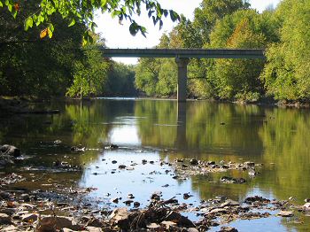
(November 2007) Enlarge Reich's Ford Road Bridge over the Monocacy stands just to the north of the battlefield. Here and at Crum's Ford just a short distance to the south elements of the 1st and 3rd Maryland Potomac Home Brigades resisted probes by Rodes' division. The fords are best seen from Pinecliff Park, north of the Battlefield Park off Reich's Ford Road |
(September 2007) The Old National Road crossed the Monocacy at the time of the battle here, where the "Jug" Bridge stood. Throughout the day spirited skirmishing between Rodes' division and Federals served to prevent Early access to a dry river crossing and a way around the Federal right flank. The 144th and 149th Ohio, of the VIII Army Corps (Middle Department) were the main units deployed here on the Federal lines, but detachments from the 159th Ohio Mounted Infantry and several of the Potomac Home Guard units were utilized here. Additionally, even further upstream to the north is Harris Ford where cavalry skirmishing occurred. Early pressed the Federals at several points, but only at the Worthington Ford did he get troops to the east of the Monocacy in any great numbers |
|||
 |
 |
|||
|
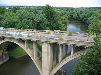
(1933) The original
Jug Bridge was built in 1808 for the National Road and was used by
notables such as the Marquis de Lafayette in their travels through
Maryland. It was named for the distinctive "jug" shaped monument that
appears on the east entrance to the bridge. On the morning of the battle,
Rodes' Division deployed on the higher ground on the west side of the
river, seen in the distance. Much of the afternoon skirmishing occurred
around the Reich house and farm, which can be seen in the upper right
corner of the photo. A toll house for the bridge also stands at the west
entrance of the bridge, and still stands today |
(September 2007) Enlarge The Jug Bridge was named after this distinctive monument that did stand on the eastern entrance to the bridge. When the bridge collapsed in the 1940s, a new modern bridge was built nearby. Later when that bridge was condemned and yet another modern span was placed over the Monocacy for Maryland Route 144, the "jug" monument was moved to its present location on the west side of the river, just south of the Frederick Airport, near where Interstate 40 passes. Incidentally, this places the "jug" at a point where Rodes' Division staged throughout the day |
|||
 |
 |
|||
|
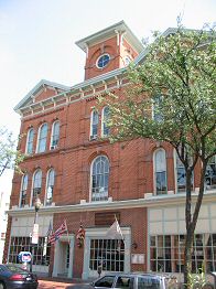
(November 2007) Frederick, MD. Enlarge On the day of the battle, General Early met with city officials to demand $200,000 in ransom here at the Old City Hall. Early made the demand in person. Confusion a few days previous with General McCausland at Hagerstown, MD over the number of zeros in the ransom note resulted in a collection of only $20,000 Throughout the day the bankers and city officials stalled the Confederates, while awaiting news from the battlefield. When the news of the Federal defeat reached town, the banks brought in the desired amount of currency in bushel baskets. To repay the debt to the banks, the city took out a bond issue in 1868, which was only retired in 1957 |
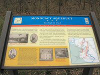
(2007) Enlarge
This 438-foot aqueduct was built between 1829 and 1833 for the
Chesapeake and Ohio Canal. The white and red quartzite stone was quarried
from nearby Sugarloaf Mountain. This aqueduct was the longest of eleven
built along the canal and cost nearly $128,000. The main design called for
seven arches, each spanning 54 feet |
|||