Phillips' Expedition of 1864 into Pontotoc County, Oklahoma

www.CivilWarAlbum.com
Civil War in Indian Territory Home
Site Index
 
This section of www.CivilWarAlbum.com courtesy of:
Dr. Carroll Messer, Ph.D, TAMU, College Station, TX
Ken Martin, Bartlesville, OK
Webmaster, Kingston, OK

Story of Phillips Expedition in Indian Territory by Dr. Carroll Messer
 
For permission to use a photo please contact Webmaster
 
Phillips' Expedition in 1864 Page1   2   3   Next


Site of Cochran's Store & Camp Kagi
1871 Survey
 

A surprise winter raid was conducted in February 1864 by the Union Armys Indian Brigade posted at Ft. Gibson, Indian Territory, on the three Confederate Indian nations located southwest across the Arkansas River. This raid, known as Phillips Expedition, resulted in the destruction of many Creek, Seminole and Chickasaw towns, and hundreds of Indian lives were lost in battle and plunder. Nearly 50 rebel soldiers were killed in the Battle of Middle Boggy, midway thru the campaign. Two days later, the main town in the northern Chickasaw Nation, Cochran, was burned to oblivion. Only recently has Phillips trail of terror been traced southwest of Ft. Gibson, so complete was the campaigns devastation. This photo album covers two major events of Phillips Expedition along the Dragoon Trail: (1) the Battle of Middle Boggy of 2-13-64, and (2) the burning of the Chickasaw town of Cochran on 2-15-64, where Camp Kagi was located. See the story of Phillips Expedition as told by Dr. Carroll Messer.

Links:
Battle of Middle Boggy
1. Battle Summary: Middle Boggy Depot
2. Battle of Middle Boggy by Dr. Carroll Messer
 
The Indian Territory in the Civil War Message Board
1. Home
2.
Camp of 14th KS Cav - Feb. 11, 1864
3. Cochrans
4.
Cochrans - Reference - Source
5. Battle of Middle Boggy on www.civilwaralbum.com

6. Further on location of Middle Boggy Battle
7. Re: Phillips Expedition - Feb 1864
8. Middle Boggy Battle
9. Battle at Middle Boggy
10. The Boggies
11. Henry Jackson's 1869 map of Indian Territory
12. Gov."Winchester Colbert"

13. Camp Kagi, ? Location
14. Place names of I. T.

15. Phillips in North Texas and Indian Territory
16. Mass grave near Stonewall, I.T.
17. Maps of the Indian Territory
Pontotoc County
1. History of Pontotoc County - RootsWeb - Ancestry.com
2. Pontotoc County - Oklahoma State University - Library
3. Pontotoc County, OK Genealogy and History - Genealogy
4. Town History of Pontotoc County, OK - Genealogy Trails
5. Pontotoc County, OK Biographies - Genealogy Trails
6. Find a Grave: Frisco Cemetery, Pontotoc County
7. Buffalo Valley: An Osage Hunting Ground by Orel Busby
8. Reminiscences of Old Stonewall - Chronicles of Oklahoma
9. Stonewall: Encyclopedia of Oklahoma History & Culture
 
Misc.
1. State of Oklahoma Genealogy Trails Data
2. Chronicles of Oklahoma: Early Trails Through Oklahoma
3. Chronicles of Oklahoma: Military Nineteenth Century
4. Territorial Kansas Online - Bio Sketch - William A. Phillips
5. William A. Phillips - Wikipedia
6. Sarah Ann Harlan: From memoirs of Life in the Indian Territory
7. Indian Refugees of the Civil War
8. Civil War Era: Indian Territory
9. The Civil War in Indian Territory  - The Story in Brief
Photos:
14th Kansas Cavalry
Camp Kagi
Camp Kansas
Clear Boggy River and Ford
Cochran Cemetery
Cochran's Store
Colbert Institute
Dragoon Trail   2   3
Frisco Cemetery
Major Willetts
Middle Boggy Battlefield
Old Stonewall
Owl Creek
Stickball Field
Texas Cattle Trail   2   3
Valley


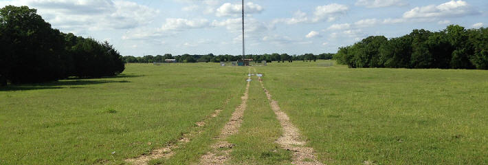
(June 1, 2015) Enlarge  Dragoon Trail and Texas Cattle Trail are believed to have passed very near the base of the transmission tower. Major Willetts may have staged his 14th Kansas cavalry's three-column attack on the Confederate picket station at Middle Boggy near this same location. Camp Kansas is believed to have been located about 0.8 miles N 20 E of the tower along the Dragoon Trail (just south of Allen)


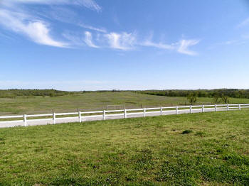
(April 20, 2013) Enlarge Valley north of the proposed site of the Battle of Middle Boggy. The Phillips Expedition traveled southwest on the old Dragoon Trail (Texas Cattle Trail) through the valley before attacking the Confederate outpost near the Middle Boggy River (aka Muddy Boggy Creek ) four miles south of Allen. View looking southwest from near the site of Camp Kansas
 
Select Back Button to Return


(April 20, 2013) Enlarge The Dragoon Trail dropped to the Middle Boggy bottom land through the draw at center of picture
 
Select Back Button to Return

(April 20, 2013) Enlarge The probable site of the Battle of Middle Boggy, February 13, 1864. Northeast Pontotoc County

 
(April 20, 2013) Enlarge Panorama of the Middle Boggy battlefield
      

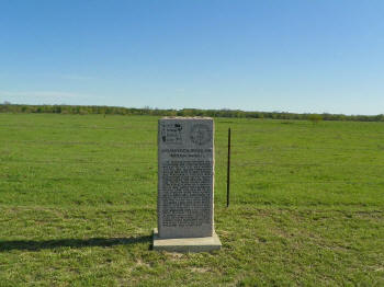
(April 20, 2013) Enlarge Historical Marker near site of the Chickasaw/Choctaw Stick Ball field, west of the Middle Boggy battlefield


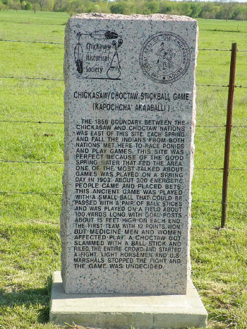
(April 20, 2013) Enlarge Close-up of the marker

Phillips' Expedition in 1864 Page1   2   3   Next

Civil War in Indian Territory Main Page--Site Index