| Champion Hill Home |
| Civil War Album Home |
| Return to Yazoo Pass - Siege of Vicksburg |
![]() nion
General Ulysses S. Grant's approach to Champion
Hill began after he received word of Confederate General Pemberton's
movements early on the morning of the 16th. Two Mississippi railroad
employees had informed Grant early that morning that Pemberton's
army had crossed the Big Black and was now in the vicinity of Edwards and
appeared to be moving eastward. Even though the information came from a
most unlikely and maybe unreliable source, Grant wasted no time in preparing
his army to move westward. The decision would prove to be critical. The
massive Army of the Tennessee set out in search of Pemberton's
army along three main routes. The southernmost force consisting of the
divisions of A.J. Smith and Francis Blair proceeded along the Raymond Road.
Two divisions commanded by Peter J. Osterhaus and Eugene A. Carr moved
along the winding Middle Road. These two forces on the Raymond and Middle
Roads were tactically under the command of John A. McClernand. The final
unit in Grant's drive to meet Pemberton was a much
larger force under James B. McPherson which proceeded down the Jackson Road
to the north. It would be McPherson's troops that
would see most of the fighting that day. By six that morning all three were
underway.
nion
General Ulysses S. Grant's approach to Champion
Hill began after he received word of Confederate General Pemberton's
movements early on the morning of the 16th. Two Mississippi railroad
employees had informed Grant early that morning that Pemberton's
army had crossed the Big Black and was now in the vicinity of Edwards and
appeared to be moving eastward. Even though the information came from a
most unlikely and maybe unreliable source, Grant wasted no time in preparing
his army to move westward. The decision would prove to be critical. The
massive Army of the Tennessee set out in search of Pemberton's
army along three main routes. The southernmost force consisting of the
divisions of A.J. Smith and Francis Blair proceeded along the Raymond Road.
Two divisions commanded by Peter J. Osterhaus and Eugene A. Carr moved
along the winding Middle Road. These two forces on the Raymond and Middle
Roads were tactically under the command of John A. McClernand. The final
unit in Grant's drive to meet Pemberton was a much
larger force under James B. McPherson which proceeded down the Jackson Road
to the north. It would be McPherson's troops that
would see most of the fighting that day. By six that morning all three were
underway.
Union Approach, May 16
 |
 |
|
|
View looking east, toward the Union
advance on the Raymond Road. The bridge in the picture is the Raymond
Road crossing of Turkey Creek. Later, the Federal advance guard would
be fired on near this creek by Confederate pickets |
Another view of the Raymond Road crossing of Turkey Creek, looking east. This picture was taken several yards west of camera position in previous photo |
|
 |
 |
|
|
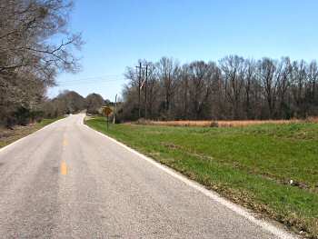
This picture is looking west down the Middle Road. Today, the Billy Fields road follows the path of the wartime Middle Road, although the eastern-most portion of what was the Middle Road is now called the Houston Road. McClernand's divisions led by Peter J. Osterhaus and Eugene A. Carr took this road on their way to Champion Hill Locate on Map |
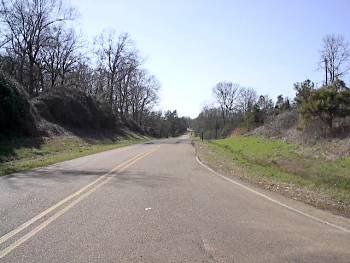
This photograph shows the terrain that Osterhaus and Carr had to maneuver through on the Middle Road. Near here, Federal advanced troops were fired upon by Confederate sharpshooters. The view is looking east toward the Union approach Locate on Map |
