 |
 |
|
|
(November 2007) Enlarge Marker-1 Marker-2 This pull off on the northeast, or Federal, side of the Rappahannock offers a trail to the buffs overlooking the river. While some 400 yards upstream from the ford itself, the bluffs offer a view of the river course. Federals defended the bluff at different times during the war to guard the ford and access to Orange County. The two markers here indicate actions during both the Battle of Kelly's Ford and later during the Battle of Brandy Station |
(November 2007) Enlarge Looking upstream from the modern bridge on a misty morning. While the modern visitor might wonder why the troopers couldn't ford the river pretty much anywhere. But to the 19th century horse bound army, the leaders had to consider tender hooves and easily impaired spoked wheels. The area just downstream from the bridge had a mill dam, and a siding canal afforded light boats a passage point round these rocks. The canal path further impeded crossing here |
|
|
|
||
 |
 |
|
|
(November 2007) Enlarge Looking downstream from the bridge, the site of the modern bridge. The ford was around 300 yards downstream from this point, where the river course bends to the left. A bridge built just prior to the war crossed the site, but apparently was dismantled or destroyed sometime during the early part of the war. The ford site was well used during the war. In addition to the crossing during this battle, it was also used during the Brandy Station battle, Chancellorsville Campaign, and on several occasions in the fall of 1863 |
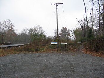
(November 2007) Enlarge From the intersection of modern CR. 672 and 620, looking south across the grounds of the Kelly's Ford Inn. Initially, Confederate pickets resisted the Federal advance here. Once they were cleared, Averell's division assembled here and prepared to move out to the northwest against Fitz Lee's troopers |
|
 |
 |
|
|
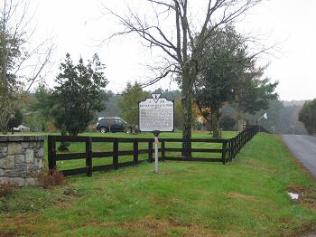
(January 2008) Enlarge Marker Kelly's Ford Inn occupies the site of the historic crossing point. At the outbreak of the Civil War, Kellysville was a thriving mill town, with a textile mill, saw mill, four mill, blacksmith shop and copper shop. Like many locations near the fall line in Virginia, water power aided industry, and transportation links soon followed. The Rappahannock canal, with limited success, allowed river boats to skirt rapids and reach this point. After the war, the industries never fully recovered and the site today is dairyland |
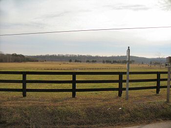
(November 2007) Enlarge High ground to the north of the intersection. Averell's left flank was anchored here while he assembled his Division. At the time of the battle, portions of Kellysville stood where the cattle graze |