Brandy Station, Virginia

Contributors:
Craig Swain: Leesburg, VA
Robert Yates: VA
 
For any use of these photos contact Webmaster


NPS Tour Map
  Links:
1.
National Park Service summary of the battle and driving tour
2. The Brandy Station Foundation Web Site
3. CWPT Page on the Battle
4. The Battle of Brandy Station

5. NPS Battle Summary
6. AmericanCivilWar.com
7. Historical Marker Database "Virtual Tour by Markers" of the Battlefield
     

Brandy Station, fought on June 9, 1863, is significant for several reasons. First, most historians generally agree it marked the beginning of the Gettysburg Campaign, the most significant of the war in the Eastern Theater. Second, it was the largest cavalry battle in the war (but not the largest all-cavalry battle, as several infantry brigades from each side were involved directly or indirectly during the day). Third, the employment of Federal cavalry in the battle indicated a growing competency with the horsemen in blue, which would strengthen over time to become the arm that forced the defeat of the Confederate armies in the Shenandoah and later at Appomattox.

Strategically, the battle came about as General Joseph Hooker, commanding the Army of the Potomac, ordered his cavalry to probe Confederate positions in Culpeper County. For the tactical details of the battle, please consult the links offered here. Generally speaking, the battle progressed in five phases. First Buford's division forcing Beverly Ford. Second the fighting along the line around St. James Church. Third, Gregg's column encountering Butler's Confederates around Hansborough Ridge. This carried forward to Fleetwood Hill and the dramatic point of the battle. Finally, the fighting shifted to Buford's Knoll on the northern edge of the battlefield.

Because this battle was fought mostly by cavalrymen, the flow of battle was not as set piece and methodical as larger, mostly infantry battles. Across the twenty or so square miles of rolling hills and deep ravines, the fighting moved rapidly to wide points as the two commands parried and thrust. Thus the visitor to the battlefield must visualize these wide ranging movements. luckily, the vistas and vantage points afforded by the efforts of preservation organizations greatly aid the interpretation of the battlefield.

Photos/text this page courtesy of Craig Swain

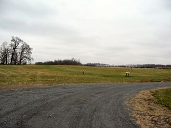
(December 2007) Enlarge Here along Beverly Ford Road, Stuart's Horse Artillery camped, while a detachment of the 6th Virginia Cavalry guarded the ford. The location of the Ford is further to the north and currently on privately held property and is inaccessible

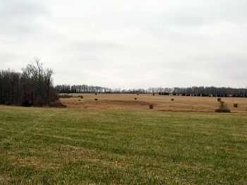
(December 2007) Enlarge Looking northeast from the high ground along Beverly Ford Road, the tall trees in the background are along Ruffans Run. The Beverly Ford road runs from the right of the photo along the edge of the field in the foreground. The road makes a wide bend on the right side of view, turning towards the parking lot seen in the first photo. In the area of that bend, Union Colonel Benjamin "Grimes" Davis of the 8th New York Cavalry became detached from his command in the confused fighting, during the opening phases of the battle. Refusing to surrender, Davis was killed by a Confederate officer. Davis is also famous as the Alabama-born Federal cavalry commander who had led his troopers out of Harpers Ferry, before the garrison's surrender in September 1862


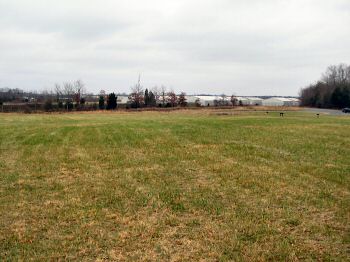
(December 2007) Enlarge Confederate artillery were camped around the high ground where the parking lot for the first tour stop is currently located. From this angle, looking back to the parking lot, Beverly Ford Road runs parallel to the modern day Airport fence line (with storage buildings and hangars in the background). The parking lot for the trail is on the right. At the time of the battle, artillery posted here would have a clear, and commanding, view along the road out nearly to the ford, affording the detailed Washington Artillery a good field of fire against the advancing Federals

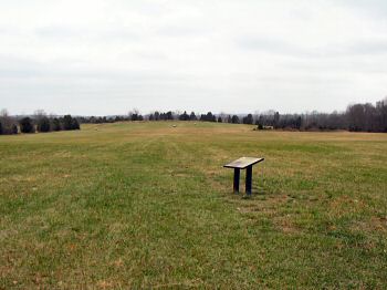
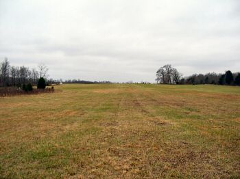
(December 2007) Enlarge Still looking from the high ground next to Beverly Ford Road. A farm lane on the left side of view heads almost due north, parallel generally to the Beverly Ford Road. Just beyond the high ground on the far side of this field is Ruffans Run. Federal and Confederate skirmishers fought across this ground in the opening phases of the battle


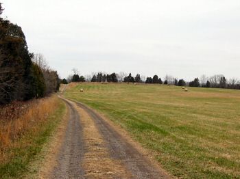
(December 2007) Enlarge Another view to the north, this along the farm lane. Where the lane crosses Ruffans Run, a bridge allows access to Buford's Knoll and the last set of wayside markers along the trail. The bridge, of course, was not in place at the time of the battle. Therefore, to some degree, the creek split the field of the north part of the battlefield into two separate fields, one here along Beverly Ford Road and the other to the north near what is now called Buford's Knoll


(December 2007) Enlarge Looking back to the south from the high ground near Ruffans Run at the ground near Beverly Ford Road (where the previous photos were taken). Cavalry under Confederate Gen. William "Grumble" Jones contested the early advances of the Federal cavalry here. This view is generally opposite that in the fourth photo
 
NEXT: Buford's Knoll

Brandy Station Page1    Page2    Page3    Page4    Page5    Page6    Page7    Next

Sites by State Home       Site Index