The Wilderness Page3
 
The Wilderness Page1   2   3   4   Next
Overland Campaign Page1


(6-2006) The Wilderness
 
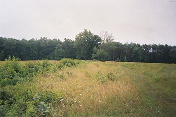
CSA Trenches Looking Right

Longstreet's First Corps of the CSA Army of Northern Virginia built these trenches. Longstreet, BTW had been wounded nearby during the battle and was no longer in command at this time. The slight rise in plants denotes the trench line. If you look toward the right center of the photo in the copse of trees the Texas Monument is visible. The open space was the farmland of the Widow Tapp. The tree line in the distance is private property (Fawn Lake, a residential community)
 
William Bozic photo


(6-2006) The Wilderness

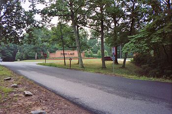
Although the tour maps indicated the land was part of the Wilderness Battlefield near the Widow Tapp farm area on the Orange Plank Road (Route #621) at the intersection with Hill-Ewell Drive, I could not help but see the obvious
 
William Bozic photo


(6-2006) The Wilderness

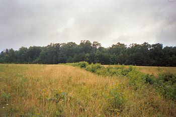
Looking Left: Widow Tapp Farm, CSA 1st Corps Trench

The rise in the plant life denotes the remains of the trench constructed by the Army of Northern Virginia's First Corps. The photo was taken from the interpretive trail which is behind the Confederate position
 
William Bozic photo
 
Markers (May 2013) courtesy of Walter Kasperczyk, NY
Information Marker: Widow Tapp's Field
Information Marker: Crisis in Tapp Field


(4-2014) Enlarge Tour Stop 1 : Grant's Headquarters
 
Bill Bechmann photo


(4-2014) Enlarge Tour Stop 2 : Wilderness Battlefield Exhibit Shelter
 
Bill Bechmann photo


(4-2014) Enlarge Tour Stop 3 : Saunders Field
 
Bill Bechmann photo


(4-2014) Enlarge Tour Stop 4 : Higgerson Farm
 
Bill Bechmann photo


(4-2014) Enlarge Tour Stop 5 : Chewning Farm
 
Bill Bechmann photo

The Wilderness Page1   2   3   4   Next     Overland Campaign Page1

Sites by State Home     Return to Site Index