Photos/text this page courtesy of
William Bozic, Houston, TX
For any use of these photos contact
Webmaster
 Battle
of Galveston 150th Anniversary Battle
of Galveston 150th Anniversary
 Galveston
2004 Galveston
2004
 Galveston
2006 Galveston
2006
 Galveston 2009 Galveston 2009
 Galveston
2011 Galveston
2011
 Galveston
2012 Galveston
2012
 Galveston
2013 Galveston
2013
 Galveston
Cemetery: www.CivilWarAlbum.com Galveston
Cemetery: www.CivilWarAlbum.com
|
Page1 Page2 |
|
 Galveston
Quarantine Station Galveston
Quarantine Station
(June 2011)
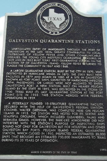
Enlarge This Texas Historical
Marker is located on Pelican Island at Seawolf Park. The marker does not
mention Fort Jackson nor the barracks and storehouses. The "Pelican Spit"
Island where these were located has been filled to merge with Pelican
Island. Hurricanes and violent storms have left no trace of anything
related to the 1861-1865 period at this spot but various activities took
place on or near this Pelican Spit.
Text of Marker
Unregulated entry of immigrants through Galveston in the late 1830s
greatly contributed to local outbreaks of yellow fever and other
communicable diseases. The young city instituted quarantine measures in
1839 and in 1853 built Texas' first quarantine station on the eastern tip
of Galveston Island. Yellow fever returned to plague the community in 1867
and 1868. A larger quarantine station, built by the city in 1870, was
destroyed by hurricane winds in 1875. The state built new facilities in
1879 and again in 1885 at a site in Galveston known as Port Point. Ships
suspected of harboring infected crew, passengers, or cargo were not
allowed to enter Galveston's port. A new station, built on nearby Pelican
Island by the state in 1892, was destroyed in the storm of 1900. Texas
built its last quarantine station at the Fort Point site in 1902. This
station merged with Federal operations in 1919. A federally funded
10-structure quarantine facility, secured with the help of Galveston's
Federal Liaison Colonel Walter Gresham, was completed here on Pelican
Island in 1915. The Pelican Island Federal Quarantine Station, which
closed in 1950, inspected an estimated 30,000 ships that brought an
estimated 750,000 immigrants to Texas during its 35 years of operation.
|
|
|
|

|
| |
|
 SS
Selma Texas Historical Marker SS
Selma Texas Historical Marker
(June 2011)
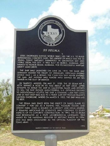
Enlarge This marker is located at
Seawolf Park. Nothing pertains to 1861-1865, but visitors will see the
ruins of the ship located just offshore.
Text of marker
Steel shortages during World War I led the U. s. to build experimental
concrete ships, the largest of which was the SS Selma, today partially
submerged in Galveston Bay and visible from this site. It was built in
Mobile, Alabama, and named to honor Selma, Alabama, for its successful
wartime liberty loan drive. The ship was launched on June 28, 1919, the
same day Germany signed the Treaty of Versailles, officially ending World
War I. As a result, the 7,500-ton ship never entered the war, but instead
was placed into service as an oil tanker in the Gulf of Mexico. In Tampico,
Mexico, on May 31, 1920, the SS Selma hit a jetty, ripping a hole in its
hull about 60 feet long. After attempts to repair the ship in Galveston
failed and efforts to sell the ship proved unsuccessful, U. s. officials
decided to intentionally scuttle the ship. A channel 1,500 feet long and 25
feet deep was dug to a point just off Pelican Island's eastern shoreline
where on March 9, 1922, the ship was laid to rest. The Selma has since
been the object of failed plans to convert it for use as a fishing pier,
pleasure resort, and oyster farm. Long a source of curiosity and local
legend, it remains important to scientists who continued to study aspects
of its concrete construction. |
|
|
|

|
|
|
|
 SS
Selma in Galveston Bay SS
Selma in Galveston Bay
(June 2011) Enlarge
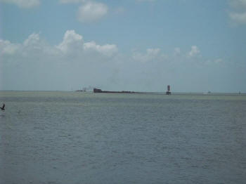
The sight of the ruins of the ship draws attention and questions, so
thankfully there is a Texas Historical Marker nearby which answers many of
the questions.
Although the SS Selma is unrelated to the Battle of Galveston, the area
around the ruin in Galveston Bay saw action in the naval portion of the
battle. In the Battle of Galveston, US Navy and Army forces were defeated
and Galveston held by the CSA until the end of the war. Surrender of the
Trans-Mississippi Dept was done at Galveston on June 19, 1865.
|
|
|
|

|
| |
|
 View
of Entrance to Galveston Bay View
of Entrance to Galveston Bay
(June 2011) Enlarge
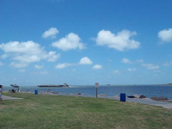
This photo was taken at Pelican Spit. To the right can be seen the edge of
Galveston Island and to the extreme right (near the umbrella) Bolivar
Peninsula can be seen. Galveston Bay is still an important and was a key
CSA port during the war. The volume of ocean-going vessels passing the
entrance is impressive. There appears to be a line out to sea of large
ships waiting to enter.
|
|
|
 |
|
|
|
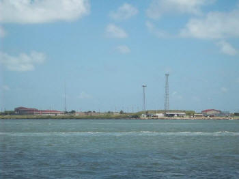 USCG
Station Galveston-Near Site of Fort Point USCG
Station Galveston-Near Site of Fort Point
(June 2011) Enlarge
Hurricanes and Violent storms have erased Fort Point, but the value of the
strategic location at the point of Galveston Island and entrance to
Galveston Bay has not been lost. Today the US Coast Guard has a station
located in roughly the same area. During the Spanish American War it was
quickly realized that harbor defenses needed to be improved. You can see
some embankments which held gun platforms, now obsolete and no longer in
use. |
| |
 |
|
|
|
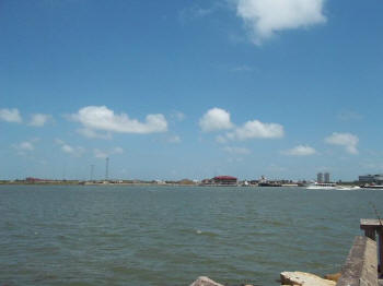 Looking
from Pelican Spit to Galveston Looking
from Pelican Spit to Galveston
(June 2011) Enlarge
The US Coast Guard Station, constructed somewhere near the site of CSA
Fort Point can be seen in the distance from the fishing pier at Seawolf
Park. (FYI-Entrance fees for Seawolf Park vary depending on desired
activities) .
The Union Army's Department of the Gulf by order of Maj. Gen. N.P. Banks
and Maj. D.C. Houston-Chief Engineer had a map of Galveston Defenses
created based on a reconnaissance by Asst. Engineer W.S. Long, and reports
furnished by refugees on April 15, 1864.
According to the aforementioned map CSA Fort Point contained the
following:
Casemate
1 Rifled Gun from the Harriet Lane*
1 8-inch Colum.
2 32-Pounders
1 8-inch Howitzer
Top Barbette
1 Rifled Gun
2 10-inch Mortars
Garrison of 200 men
*The Harriet Lane was a US Ship taken by Confederates during the naval
portion of the Battle of Galveston |
|
|
 |
|
|
|
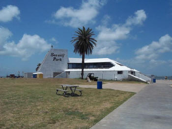 Seawolf
Park Pavillion Seawolf
Park Pavillion
(June 2011) Enlarge
This building is closed and gutted. (Photo taken June 26, 2011) Portable
bathrooms are outside the structure to accommodate visitors. Hurricane IKE
submerged the park but the island has been submerged on other occasions,
too.
Pelican Spit and Pelican Island were of obvious strategic importance. The
Union Army's Department of the Gulf by order of Maj. Gen. N.P. Banks and
Maj. D.C. Houston-Chief Engineer a map of Galveston Defenses was created
based on a reconnaissance by Asst. Engineer W.S. Long, and reports
furnished by refugees on April 15, 1864.
According to the aforementioned map there were 25 torpedoes of 25 pounds
of powder each to mine the area. Defenses on Fort Jackson, which was
located on Pelican Spit facing the channel, as well as on Fort Point, were
in place to ensure a cross-fire.
The following was believe by Union forces to be in place based on the map
above cited.
Fort Jackson
Casemate
1 8-inch Colum.
2 32 Pounders
Top Barbette
1 8-inch Colum.
1 10-inch Mortar
No details were given in the US map for the CS garrison in the barracks,
nor contents of the storehouses, on Pelican Spit.
|


