|
Shiloh
National Military Park Additional Sites on the Battlefield Page4 |
||
 |
 |
|
|
(3-04)
Enlarge
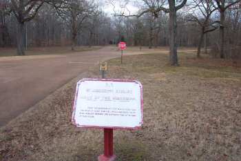
Riverside Drive marker for the Kentucky regiments at the Battle of Shiloh.
Riverside Drive at one time was on the tour route. It was closed after the
Dill Branch crossing washed out. In 2012 it was back on the tour route |
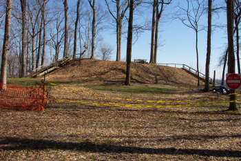
(3-04)
Enlarge
Riverside Drive. The largest of the Indian Mounds
at Shiloh National Military Park. It is
probably from this mound that Forrest observed the Federals being
reinforced from across the Tennessee River, late evening, April 6, 1862 |
|
 |
 |
|
|
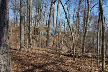
(3-04)
Enlarge Another
view of the mound in previous photos, with the Tennessee River in the
background. See Dill Branch Ravine for a view of the mound from across the river |
(3-04)
Enlarge
Corinth-Pittsburg Landing Road
approximately 1/2 mi. southwest of Tour Stop-2 (Grant's Last Line) |