|
Photos/text this page courtesy of Lee
Hohenstein, Omaha, NE For any use of these photos contact Webmaster |
Links: 1. Battle Summary: Aldie, VA 2. Aldie Markers - The Historical Marker Database 3. Battle of Aldie - Wikipedia 4. History Of The Rte 50 Corridor 5. Calvin Douty and the Battle of Aldie 6. Battle of Aldie (pdf) 7. Snickersville Turnpike Association |
||
 |
 |
||
|
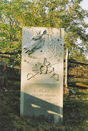
(October 2007)
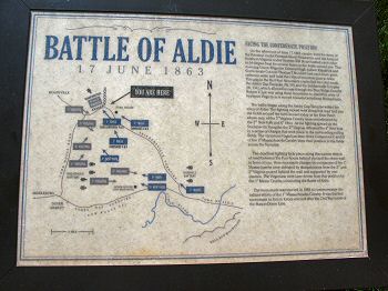
Enlarge Aldie Interpretive Marker |
(October 2007)
Enlarge
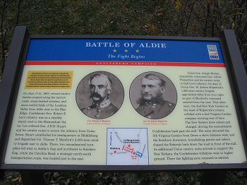
Aldie Interpretive Marker |
||
|
|
|||
 |
 |
||
|
(October 2007)
Enlarge
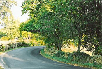
Looking back at the curve in the road from the north side battle site, a
split rail fence lined the north side of the road while a stone wall
lined the south side. This wall concealed a steep drop off into a field
and at that time the road was cut deeper in to the earth than now. The
wall concealed sharpshooters from the 2nd and 3rd Virginia Cavalry from
view as the 1st Mass. Cavalry rode into an ambush |
(October 2007)
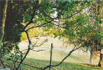
Enlarge A closer
view of the drop off and sunken field |
||
 |
|||
|
(October 2007) Enlarge Side Panels In 1880 the survivors of the 1st Mass. Cavalry erected this monument on the curve to commemorate this important battle. The names of the casualties are engraved on the right edge of the monument |
|||