 |
 |
|
|
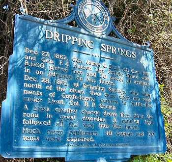
Enlarge Interpretive marker for the Battle of
Dripping Springs, AR |
When the Federals reached Dripping Springs, they found the Confederates camped on the northern slope of a substantial ridge. Forming into a line of battle, they advanced across fields and open ground and engaged the Confederate line of battle in a short firefight |
|
 |
 |
|
|
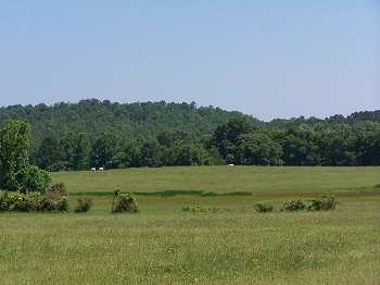
This is a view from the top of the ridge looking down in the direction of the crossroads at Dripping Springs. The Federal advance came up the hill from the right. The Confederates, heavily outnumbered, gave way in the face of the charge and fled over the hill to the left and onto the road to Van Buren |
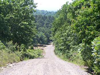
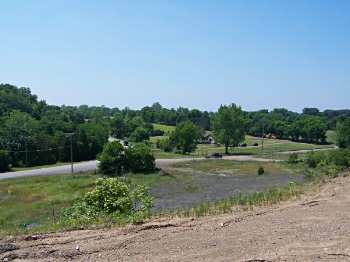
This is a view from the top of the ridge looking down on the crossroads at Dripping Springs. The road visible in the left of the photograph is the Old Uniontown Road leading south to Van Buren. The Confederates retreated quickly from the battlefield, but made a few attempts to stand along the way. Even so, the Federals reached Van Buren (about 8 or 9 miles away) in roughly an hour |