|
Fort Hoskins was one of three forts
built in the Oregon territory to protect white settlers from coastal
Indians on the Siletz Reservation and to protect those same Indians from
white settlers.
By all accounts from both military records, and from journals kept by two
soldiers stationed at the fort, it was a lonely and quiet post. But, Fort
Hoskins and its northern twin, Fort Yamhill had solid connections to the
American Civil War. The third fort was Fort Umpqua to the south.
The first connection was in the person of Captain Christopher Columbus
Augur. Already a veteran of the US-Mexican War, he would later go on to
become a general during the Civil War commanding a division in one of the
Civil Wars last battles at the siege of Port Hudson. He was also in
command of the troops protecting Washington D.C. and commanded the detail
of soldiers who marched with Abraham Lincoln�s body. After the war he
would play a major role in Indian negotiations in the Midwest.
At the command of Brig. General John E. Wool, Captain Augur scouted the
site of Fort Hoskins. He located it on a ridge above the Luckiamute Indian
trail and near the community of Kings Valley. The location was ideal as it
watched over one of two trails into the Siletz Valley and Indian
Reservations, and was able to draw upon the local community for goods and
services when needed.
The �fort� was constructed during the winter of 1856-1857 by a second
Civil War connection, General Philip Sheridan whose calvary was
instrumental in forcing the surrender of Gen. Robert E. Lee at Appomattox
and thus ending the Civil War.
Unfortunately Sheridan was only a lowly second lieutenant and the most
junior officer at this time. He was originally assigned to Fort Yamhill,
but was detailed to build a military road, build and garrison a couple of
blockhouses closer to the reservation, and was in charge of building Fort
Hoskins. After the Fort was built, he would remain there as Quartermaster.
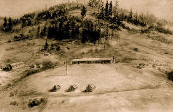
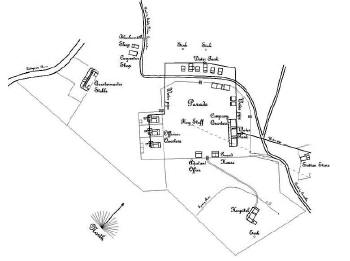
The fort itself wasn�t a traditional fort. It lacked any type of
fortifications except a guard house that was mostly used as a jail. It had
15 to 20 buildings arranged across the bluff around a 100 foot tall flag
pole. The entire thing was surrounded by a low picket fence.
By the time the Civil War broke out in 1861, Fort Hoskins was no longer
needed. It�s soldiers were redeployed to the East Coast and
and the fort was garrisoned by Union volunteers
from California and Oregon. It was finally shut down on April 16th, 1865
and all the property was sold at auction. Many of the buildings were moved
to nearby towns, although Samuel and Mary Frantz lived in the hospital
until they built their own home nearby.
The town of Hoskins sprung up next to the fort site, built with some of
these buildings. Unfortunately all these buildings now seem to be long
gone.
Despite that, during the Civil War the fort was of interest to both the
South and Southern sympathizers living in the Oregon Territory at the
time. One of them, The Knights of the Golden Circle, headquartered in
Monroe Oregon reportedly drew a crowd of 1000 people to attack and seize
the fort and the ammunition and guns stored there. It is also reported
that the crowd was too drunk to do so.
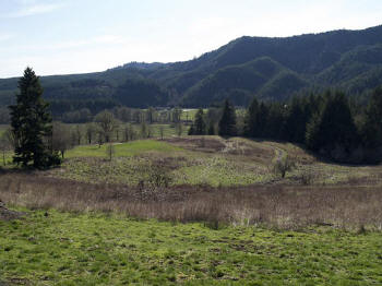
The fort site was added to the National Register of Historic Places in
1974. Benton County took over the site in 1992 and have restored it as a
park. Since then it has undergone multiple archeological digs led by David
Brauner, an archaeologist at Oregon State. The most interesting event
though is that one of the original buildings was found in nearby Peedee
and has been returned to the Fort�s grounds. This house was thought to
have been Captain Auger�s quarters during his stay here. When it was sold
it was dismantled and floated down the Luckiamute River. It was moved back
in 2012 and has been erected on it�s original site.
*Update* Since this original writing, one of the Fort�s original buildings
has been moved back to the Fort.
Ben Maxwell took a picture of it in 1959 where it was located in the town
of Peedee. Marcus Gilliam purchased it and floated it down the Luckiamute
to what would become the town of Peedee. William Condron purchased the
house and farm in 1929 from the Gilliam Family.
Visit Fort Hoskins
Directions to Fort Hoskins. From Salem Oregon, head west on Highway 22 to
Rickerall. Take a left onto Highway 99W, and pass through Monmouth Oregon.
At 7.3 miles turn right onto Airlie Road, until you get to Airlie (the
town was not marked on my 2013 visit, so watch for the road signs.) Turn
left onto Maxfield Creek Road. At 7.4 miles turn left on to OR-223 S. It
should be marked with a sign pointing to Kings Valley and Peedee. At 1.5
miles turn right onto Hoskins road. At about one mile you�ll see the
Frantz-Dunn House on your right. The Park�s entrance is another half mile
on the right.
Courtesy of Rick Hammel
Portland, Oregon |


