|
(March 2009) Enlarge Marker at the site.
The marker is located at the end of Missouri Highway 80, best reached by
traveling east from the town of East Prairie |
|
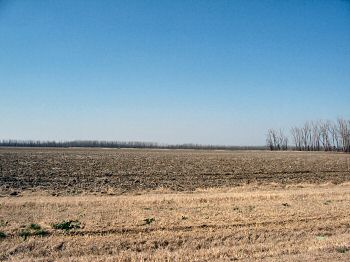
(March 2009) Enlarge The main part of
the battlefield. Looking from Missouri Highway 80 to the north across
the battle area. At the time of the battle, this was heavily timbered
bottom land. In this vicinity, the 27th Illinois, commanded by Col.
Napoleon B. Buford, marched along a road to catch the main Confederate
line on the south flank, helping to collapse the initial defense. The
far tree line in the center and left edges the old river bottom. Thus
across that ground the rest of the Federal line sparred with PillowÆs
Confederates. The ōpondö was likely to the left of this view. The field
is private property |
|
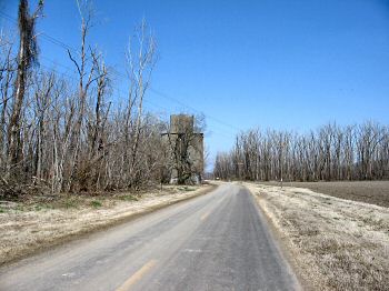
(March 2009) Enlarge Location of the
"town" of Belmont. A grain elevator is all that remains visible to the
casual visitor. The town itself didn't grow in size until after the war,
as a rail-to-barge transshipping point. The railroad bed followed the
road at this point up to the river bank. At the time of the war, the
railroad was not here, but a plank road allowed the 27th Illinois to
slip onto the left flank of the Confederate lines |
|
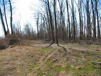
(March 2009) Enlarge Timbered bottom
lands. Looking at the stand of trees where Belmont once stood. The
ground today is reminiscent of the swampy timbered bottom lands over
which the combatants fought |
|
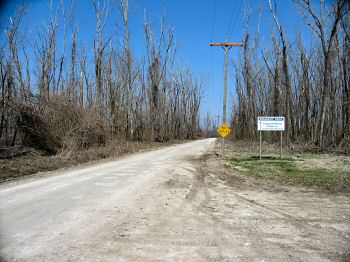
(March 2009) Enlarge Based on the
location of Belmont and the old railroad trace, the Confederate camp
must have been to the north of the marker location. Likely the spot was
to the left of the road in this view. Today the area is a dead end at
the river bank. The land beyond this point is private property |
|
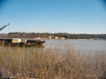
(March 2009) Enlarge Looking from the
Missouri shore toward Columbus, Kentucky. The river is approximately 800
yards wide at this point. The bluffs on the Kentucky side have eroded
somewhat since the war, but are still imposing. In the center of view on
the bluffs are pavilions in Columbus-Belmont State Park. The giant chain
spanned the river near this point. And of course to the left is a river
barge, indicating this section of the river sees a lot of traffic even
in modern times |