 |
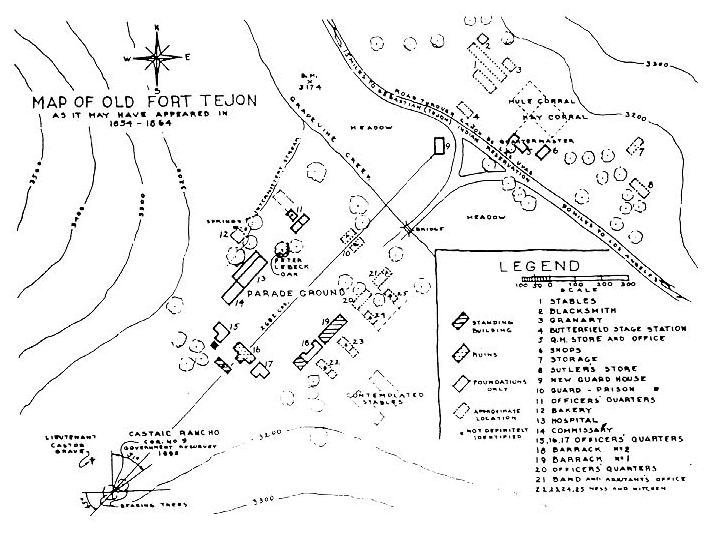
| Map of Old Fort Tejon as it may have appeared in 1854 - 1864. Modern entrance is near the bridge across Grapevine Creek. Modern freeway (Interstate 5) follows the path of the original road in upper right. Map courtesy of Don Worth |
|
| Map of Old Fort Tejon as it may have appeared in 1854 - 1864. Modern entrance is near the bridge across Grapevine Creek. Modern freeway (Interstate 5) follows the path of the original road in upper right. Map courtesy of Don Worth |
![]()